
Live in College Park
1920s bungalows on a chain of lakes, with streets named after universities and a main street that still works.
College Park was platted in the 1920s land boom north-west of downtown, on and between a chain of lakes, and its developers named the streets after universities (Princeton, Harvard, Yale, Vassar) which is where the name comes from. There was never a college. What there is instead is the thing central Florida is short of: a walkable commercial main street on Edgewater Drive, small lots, mature oak canopy and pre-war houses, all of it four miles from downtown. It is old Orlando in the way Seminole Heights is old Tampa. The trade is the age of the stock, which predates every modern wind code and which an insurer prices accordingly, and the proximity of a boundary. Winter Park is a separate municipality with its own council and its own millage a short distance east, and the line is not obvious on the ground. At a USGS-measured 103.9 feet, this is the highest of the Orlando guides on this site.
Streets named after universities, and no college
North-west of downtown between I-4 and Lake Ivanhoe, running north along Edgewater Drive through the chain of lakes toward Lake Adair and Lake Silver.
College Park was platted in the 1920s land boom north-west of downtown, on and between a chain of lakes, and its developers named the streets after universities. Princeton, Harvard, Yale, Vassar. There was never a college. What there is instead is the thing central Florida is short of: a walkable commercial main street on Edgewater Drive, small lots, mature oak canopy and pre-war houses, four miles from downtown.
It is old Orlando in the way Seminole Heights is old Tampa. A neighbourhood that kept its street grid and its main street while the rest of the metro rebuilt itself around cars. That scarcity is what you are paying for, and it has held its value accordingly.
At a USGS-measured 103.9 feet this is the highest ground of the Orlando guides on this site, which in a state where the other two city hubs here sit at six and nine feet is worth stating plainly. Storm surge does not reach central Florida. Wind does, and the local reference is Hurricane Charley crossing the city in 2004 rather than any coastal event.
The trade is the age of the stock and the boundary next door. Most of these houses predate the 1994 wind code, and a wind mitigation report will move the insurance quote further than anything on the Orlando hub. And Winter Park is a separate municipality with its own council and its own millage a short distance east: the line is not obvious on the ground, and it changes the tax bill without changing the school district.

- Get a wind mitigation report before offering; on 1920s stock it moves the premium more than the price does
- Confirm which municipality the address is in. Winter Park's boundary is close and its millage is different
- The oak canopy is the neighbourhood's best feature and a standing maintenance cost; budget for tree work
- No community development district here: pre-war Orlando predates them entirely
- Freshwater flooding around the chain of lakes is a lot-by-lot question; get a flood quote on the specific property
- Edgewater Drive is the reason the neighbourhood works; check what is actually open rather than what a listing claims
How College Park got here
- 1921The subdivisions that become College Park are platted north-west of downtown, on the chain of lakes.
- 1920sThe Florida land boom builds out most of the surviving bungalow stock, with streets named after universities.
- 1950sEdgewater Drive consolidates as the neighbourhood's commercial main street.
- 1960sI-4 is built along the eastern edge, cutting the neighbourhood off from downtown more sharply than the distance suggests.
- 2000sReinvestment along Edgewater Drive turns the strip over, and the neighbourhood's prices move with it.

Lake Adair, Lake Ivanhoe and Dubsdread
The neighbourhood is built between lakes and uses them as its open space. Lake Adair and Lake Silver sit inside it; Lake Ivanhoe marks the southern edge with the Ivanhoe Village strip beside it. Dubsdread, the public golf course laid out in 1924, occupies the middle and functions as much as a social centre as a course.

The resident's angle: the canopy is why the streets are pleasant to walk from October to May and why the tree budget is not optional. Limbs come down in summer storms, and a mature oak over a 1920s roof is a commitment rather than a decoration.
18 places, with real drive times
Road-adjusted distance and drive time from the centre of the community to each destination, nearest first. Filter by category.
Showing 1–12 of 18 places, nearest first.
Method: distances and drive times are computed from a representative point in the neighbourhood, using straight-line distance multiplied by a road factor and a tiered speed model: honest ranges, not routed times. Note that I-4 runs along the eastern edge, so the drive to downtown is shorter than the straight line suggests and the walk is longer.
Every gym within reach
Dubsdread is the neighbourhood institution, and the lake paths are the daily route. Commercial provision clusters along Edgewater Drive, which is walkable from most of the neighbourhood.
- Public, in the neighbourhood, and with a restaurant that functions as its social centre
- The lake paths at Ivanhoe and Adair are the nearest continuous walking loops
- Commercial gyms and studios along Edgewater Drive, which is walkable from most addresses
- The shaded residential grid is the practical running route from June to September
| Facility | What it is | Drive |
|---|---|---|
| Dubsdread Golf Course open | The 1924 public course at the middle of the neighbourhood, with a restaurant that functions as its social centre. | 4–6 min |
| Lake Ivanhoe open | The lake path at the southern edge, and the nearest continuous walking loop. | 4–6 min |
The free option is the canopy and the lake paths. The neighbourhood is one of very few in this metro pleasant enough to walk without a destination.
Assigned inside the neighbourhood, which is rare here
College Park is unusual in central Florida in having its assigned schools inside it: Princeton Elementary, College Park Middle and Edgewater High are all in the neighbourhood, which is part of what people pay for. Orange County Public Schools runs magnet and choice programmes county-wide alongside assignment.
| School | Board | Note |
|---|---|---|
| Princeton Elementary School | Orange County Public Schools | The neighbourhood public elementary. Orange County assigns by address; check the specific address rather than the neighbourhood. |
| College Park Middle School | Orange County Public Schools | The assigned middle school, inside the neighbourhood. |
| Edgewater High School | Orange County Public Schools | The assigned public high school, at the middle of the neighbourhood, which is unusual in central Florida and part of what people pay for here. |
| Orange County's choice programme | Orange County Public Schools | Magnet and choice programmes run county-wide alongside assignment. Apply in the district's window. |
| Winter Park schools | Orange County Public Schools | Winter Park is a separate municipality but the same school district. The city line does not move the assignment, and the boundary between catchments is not the boundary between cities. |
Winter Park next door is a different municipality but the same school district: the city line does not move the assignment, and the boundary between catchments is not the boundary between cities. Check the specific address in the district's boundary lookup.
Month by month, what living here looks like
Not a highlights reel: the actual annual rhythm, including the dates residents have to remember.
- Highs around 22 °C and lows near 10: the coolest, driest stretch of the year
- Peak season for visitors, and traffic on I-4 to match
- Canopy and lake breeze make this the pleasantest stretch of the year
- The driest month on average and the best for anything outdoors
- Theme-park crowds are lighter than at Christmas and heavier than in September
- Comfortable enough to walk the lakes at midday
- Warming into the high twenties; humidity returns late in the month
- Spring break brings the metro's heaviest visitor traffic of the year
- Pollen from the oaks is at its worst
- Warm, still mostly dry, and the last month before the air changes
- Insurance renewals cluster before hurricane season
- Get a wind mitigation report; on 1920s stock it moves the premium more than anything else
- The rainy season begins, usually in the second half
- Afternoon thunderstorms become a daily fixture
- Central Florida is the most lightning-prone region in the United States
- Atlantic hurricane season runs 1 June to 30 November
- Daily storms and mid-thirties with humidity
- Oak limbs come down in summer storms. Budget for tree work every spring
- The hottest and wettest month; outdoor life moves to early morning and after dark
- Lowest rates of the year on short leases
- Afternoon storms are reliable enough to plan around
- Peak humidity and the start of the serious part of hurricane season
- A hundred feet above sea level: this is the highest ground of the Orlando guides here
- Quietest month for restaurants and the easiest to get a table
- Statistically the peak of Atlantic hurricane activity
- Binding restrictions mean you often cannot buy a new policy with a named storm in the basin
- Wind rather than water is the risk, and the 2004 season is the local reference
- The rains taper off and the humidity finally breaks
- Still hurricane season, and October storms have crossed the peninsula before
- The best month of the year for the lakes
- Hurricane season ends on 30 November and the dry season starts
- Comfortable enough to be outside all day again
- Snowbird traffic returns and the metro fills
- Warm days, cool evenings and almost no rain
- Peak season proper begins and the parks are full
- The pay-off for August
20 photographs of Orlando and the region
Drawn from the site's shared, freely licensed Orlando photo library, not photographs of College Park itself. Filter by category.

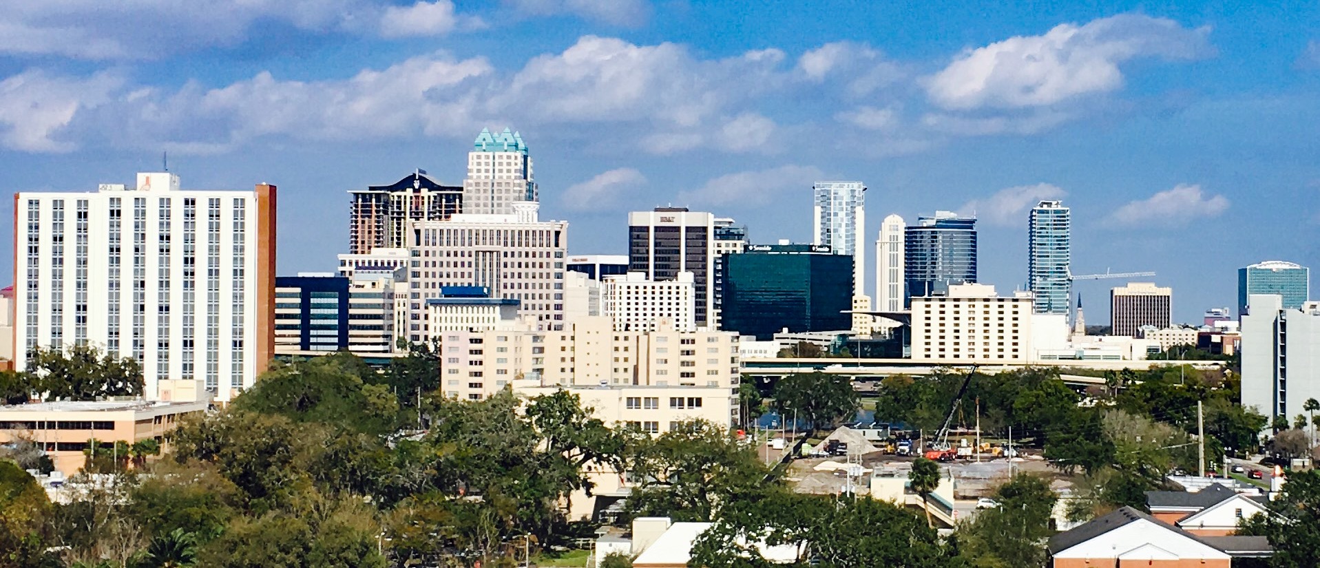


Showing 1–12 of 20 photographs.
About these photographs. Openly licensed images geotagged in or near College Park, found on Wikimedia Commons and served from there with full attribution. Inline photos elsewhere on the page may still come from the site's shared Orlando library.