
Live in Thornton Park
Brick streets and bungalows a few minutes' walk from the office towers. The walkable case in a city built for cars.
Thornton Park is the small grid of brick streets immediately east of Lake Eola, and it is the answer to the question of whether you can live in Orlando without a car. Mostly you cannot; here, more or less, you can. The neighbourhood is 1920s bungalows and small apartment buildings with a commercial strip on Washington and Summerlin, a few minutes' walk from downtown offices and from a lake that is genuinely the middle of the city. Lake Eola is a sinkhole, which is a very Floridian way for a city to acquire a park. What you are buying is scarcity: this pattern of streets barely exists anywhere else in central Florida. What you should check is the geology and the designation, because the chain-of-lakes ground here produces freshwater flooding and, occasionally, sinkholes, and parts of the neighbourhood sit in local historic districts that constrain what you may do to a façade. At a USGS-measured 75.6 feet above sea level, the coastal storm-surge argument that dominates this site's Miami and Tampa pages does not apply.
The one part of Orlando where walking is the default
East of Lake Eola and downtown, roughly between Summerlin Avenue and Mills Avenue, with Lake Eola Heights to the north and Delaney Park to the south.
Thornton Park is a small grid of brick streets immediately east of Lake Eola, and it is the answer to the question of whether you can live in Orlando without a car. Mostly you cannot. Here, more or less, you can: 1920s bungalows and small apartment buildings, a commercial strip on Washington and Summerlin, and the office towers a few minutes' walk away across the park.
The lake at the middle of the city is a sinkhole. That is not a figure of speech: Lake Eola is a collapse feature in the limestone, which is a very Floridian way for a city to acquire its central park. It also tells you what the local ground risk actually is here, and it is not the one the rest of this site's Florida pages are about.
At a USGS-measured 75.6 feet above sea level, storm surge is not the question. Orlando is forty miles inland and eighty feet up; the coastal argument that dominates the Miami and Tampa pages on this site simply does not reach here. What does reach here is wind (Hurricane Charley crossed the city in 2004) and freshwater flooding around the chain of lakes, which is a lot-by-lot question rather than a neighbourhood one.
Two things to check. Whether the property sits in a local historic district, because parts of Thornton Park and Lake Eola Heights do and that constrains exterior work. And the age of the construction: pre-war stock predates every modern wind code, and a wind mitigation report will move an insurance quote further than the price will. What you will not find here is a community development district assessment: those are a feature of the newer parts of this metro, and 1920s Orlando predates them entirely.

- Establish whether the address is in a local historic district before planning any exterior work
- Pre-war stock predates every modern wind code. Get a wind mitigation report before you offer
- Freshwater flooding and sinkholes are lot-by-lot questions on this chain-of-lakes geology; ask about the specific property
- No community development district here, which is a real saving against the newer parts of the metro
- The walkability is genuine and very small in extent. It means the blocks around the lake and little else
- Winter Park is a separate municipality with a different millage a short distance north; confirm which city an address is in
How Thornton Park got here
- 1892Lake Eola Park is established around the sinkhole lake that becomes the centre of the city.
- 1900sThe blocks east of the lake are subdivided and built out with bungalows and small apartment buildings.
- 1920sThe Florida land boom fills in most of the surviving housing stock, and the brick streets are laid.
- 1980sDowntown Orlando's office towers go up on the western side of the lake, and the neighbourhood becomes a walk-to-work address.
- 1990sLocal historic districts are established over parts of the area, protecting the pre-war fabric.
- 2000sThe commercial strip on Washington and Summerlin consolidates as the neighbourhood's centre.

Lake Eola, Constitution Green and Delaney Park
Lake Eola Park is the neighbourhood's front yard and the city's central public space: a loop just under a mile, a swan-boat fleet, and the Sunday farmers' market. Inside the neighbourhood, Constitution Green is a small park built around a live oak said to be centuries old. South, Delaney Park has the playing fields. It is a better provision than most of Orlando manages, and it is walkable, which almost none of Orlando manages.


The resident's angle: the lake loop is the single most-used piece of public space in the city and is busy from dawn. It is also the reason a Thornton Park address costs what it does: you are paying for the walk, not the square footage.
18 places, with real drive times
Road-adjusted distance and drive time from the centre of the community to each destination, nearest first. Filter by category.
Showing 1–12 of 18 places, nearest first.
Method: distances and drive times are computed from a representative point in the neighbourhood, using straight-line distance multiplied by a road factor and a tiered speed model: honest ranges, not routed times. The drive column overstates the difficulty of the first two groups, most of which are a genuine walk from here.
Every gym within reach
The lake loop is the answer for most residents, and Delaney Park south has the municipal playing fields. Downtown's commercial gyms are a short walk west.
- Busy from dawn, and the city's default running route
- Delaney Park to the south has the nearest municipal playing fields
- Downtown's commercial gyms are within a walk, which is unusual in this metro
- The Sunday farmers' market takes over part of the loop
| Facility | What it is | Drive |
|---|---|---|
| Lake Eola Park open | The lake loop is just under a mile and is the neighbourhood's actual exercise infrastructure: flat, lit and busy from dawn. | 3–4 min |
| Delaney Park open | Playing fields and open ground immediately south, with the nearest municipal recreation. | 5–7 min |
The free option is the loop itself, and in a city where almost everything requires a car it is worth more than a membership.
Assigned by address, chosen county-wide
Most Thornton Park addresses fall to Lake Como School, then Howard Middle and Edgewater High in College Park. Orange County Public Schools is county-wide and runs a substantial magnet and choice programme alongside assignment, which in the downtown neighbourhoods is how a good many families are actually placed.
| School | Board | Note |
|---|---|---|
| Lake Como School | Orange County Public Schools | The neighbourhood K-8 public school. Orange County assigns by address and runs a substantial choice programme alongside; check the specific address. |
| Howard Middle School | Orange County Public Schools | The assigned middle school for much of downtown Orlando. |
| Edgewater High School | Orange County Public Schools | A large public high school in College Park, and the assigned high school for part of this area. |
| Orange County's choice programme | Orange County Public Schools | Magnet and choice programmes run county-wide alongside assignment. Apply in the district's window rather than relying on the catchment. |
| Independent schools | Independent | Downtown and the neighbourhoods around it have a modest independent sector, with more of it in Winter Park immediately north. |
Orange County Public Schools assigns by address, and downtown boundaries have moved as the residential population has grown. Check the specific address in the district's boundary lookup, and apply in the choice window if a magnet place matters to you.
Month by month, what living here looks like
Not a highlights reel: the actual annual rhythm, including the dates residents have to remember.
- Highs around 22 °C and lows near 10: the coolest, driest stretch of the year
- Peak season for visitors, and traffic on I-4 to match
- The Lake Eola loop is at its best and busiest
- The driest month on average and the best for anything outdoors
- Theme-park crowds are lighter than at Christmas and heavier than in September
- Comfortable enough to walk the lakes at midday
- Warming into the high twenties; humidity returns late in the month
- Spring break brings the metro's heaviest visitor traffic of the year
- Pollen from the oaks is at its worst
- Warm, still mostly dry, and the last month before the air changes
- Insurance renewals cluster before hurricane season
- Freshwater flooding and sinkholes are lot-by-lot questions here. Ask about the specific property
- The rainy season begins, usually in the second half
- Afternoon thunderstorms become a daily fixture
- Central Florida is the most lightning-prone region in the United States
- Atlantic hurricane season runs 1 June to 30 November
- Daily storms and mid-thirties with humidity
- Afternoon storms make the walk to downtown a timing exercise rather than a given
- The hottest and wettest month; outdoor life moves to early morning and after dark
- Lowest rates of the year on short leases
- Afternoon storms are reliable enough to plan around
- Peak humidity and the start of the serious part of hurricane season
- Seventy-five feet up and forty miles inland: storm surge is not the risk here, wind is
- Quietest month for restaurants and the easiest to get a table
- Statistically the peak of Atlantic hurricane activity
- Binding restrictions mean you often cannot buy a new policy with a named storm in the basin
- Hurricane Charley crossed the city in 2004, which is the local reference point rather than a coastal surge
- The rains taper off and the humidity finally breaks
- Still hurricane season, and October storms have crossed the peninsula before
- The best month of the year for the lakes
- Hurricane season ends on 30 November and the dry season starts
- Comfortable enough to be outside all day again
- Snowbird traffic returns and the metro fills
- Warm days, cool evenings and almost no rain
- Peak season proper begins and the parks are full
- The pay-off for August
20 photographs of Orlando and the region
Drawn from the site's shared, freely licensed Orlando photo library, not photographs of Thornton Park itself. Filter by category.

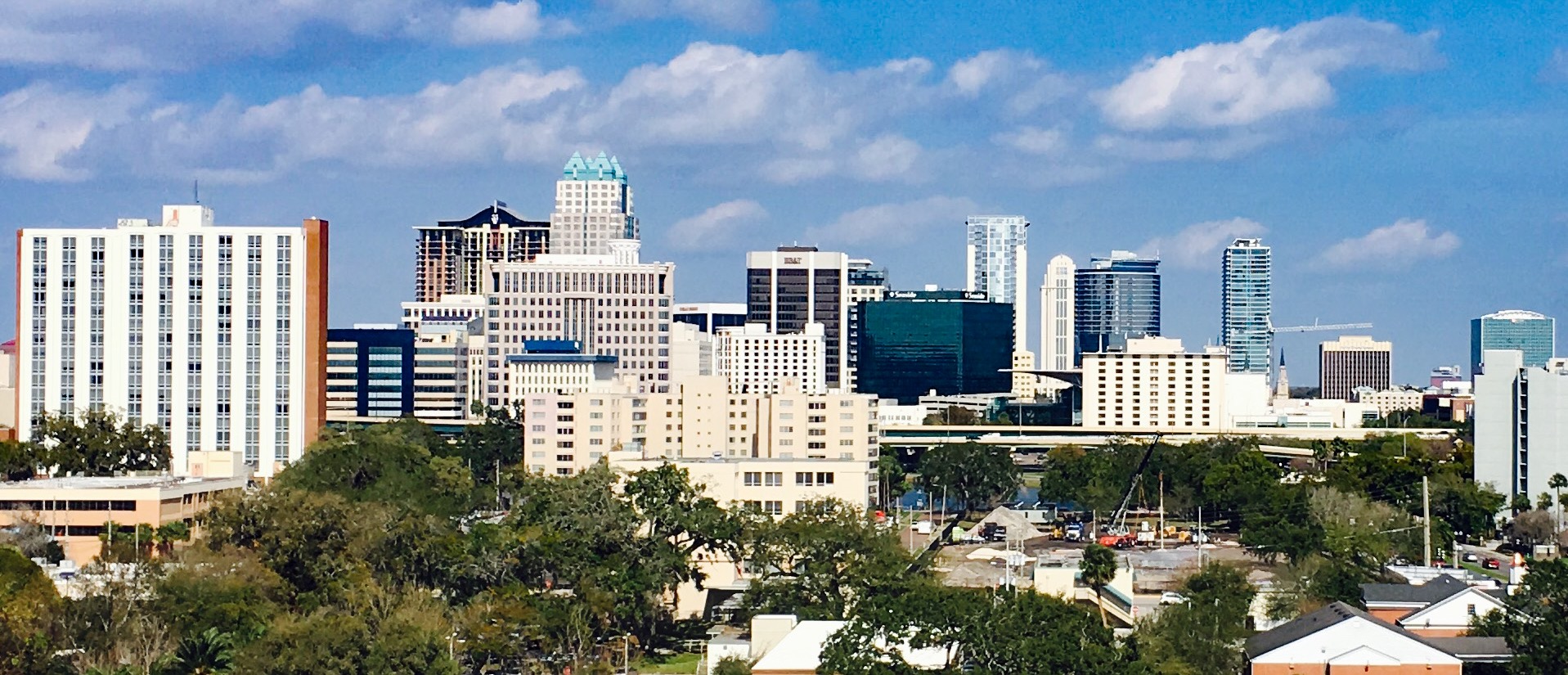


Showing 1–12 of 20 photographs.
About these photographs. Openly licensed images geotagged in or near Thornton Park, found on Wikimedia Commons and served from there with full attribution. Inline photos elsewhere on the page may still come from the site's shared Orlando library.