Live in Silverado
A 2000s community south of Stoney Trail, built against a city-mandated wetland buffer with Spruce Meadows on the other side.
Silverado was annexed by the city in 1984 but sat undeveloped until home construction began in 2005: 6.0 km², 7,975 residents in 2,545 dwellings at the 2021 census, with rental housing at just 13%. Stoney Trail forms the northern edge, Spruce Meadows' show-jumping grounds sit immediately west across a city-mandated wetland buffer, and Sheriff King Street carries traffic east to Macleod Trail. It is one of the most ownership-heavy communities in this batch, and one of the youngest — a quarter of residents are still under 15, a share few established communities can match. This is what living here is actually like.
A 2000s community built against a wetland buffer
Bounded by Stoney Trail to the north, Sheriff King Street to the east, 194 Avenue SW to the south, and the Spruce Meadows wetland buffer to the west. Ward 13.
Silverado was annexed by the city in 1984 but sat undeveloped for two decades. Home construction began in 2005, and by the 2021 census the community had 7,975 residents in 2,545 dwellings — 6.0 km² of land, with rental housing at just 13%.
The two edges. Stoney Trail forms the northern boundary; south of it, Spruce Meadows' show-jumping grounds sit immediately west across a wetland buffer the city required before approving construction in 2004. Sheriff King Street carries the community's own traffic east to Macleod Trail.
Who lives here. A quarter of residents are under 15 — a share few established communities can match — and 87% of households own rather than rent. Ron Southern School opened inside the community in 2017 and has run ahead of its own enrolment projections since.
The build-out was fast. The community grew 18% in a single year during its 2011–12 peak. That pace shows in the housing stock: almost everything here was built within the same fifteen-year window, so the streetscape reads as uniform rather than layered.

- Almost all housing dates from a single fifteen-year build-out — expect uniform stock, not a mix of eras
- Ron Southern School has run over capacity since opening; confirm current enrolment before counting on it
- No CTrain station in the community — the nearest Red Line platform is a nine- to thirteen-minute drive
- A quarter of residents are under 15, so school and playground crowding is a real, current issue here
- Future LRT stations at Silverado and 210 Avenue are planned but unfunded — do not price them in
How Silverado got here
- 1984The land is annexed by the City of Calgary.
- 2004Council approves a wetland buffer between the planned community and Spruce Meadows.
- 2005Home construction begins in Silverado.
- 2012Civic census records 5,136 residents, an 18% jump in a single year at the height of the build-out.
- 2017Ron Southern School opens inside the community.
- 2021Federal census records 7,975 residents in 2,545 dwellings, with rental housing at 13%.




A show-jumping venue for a next-door neighbour
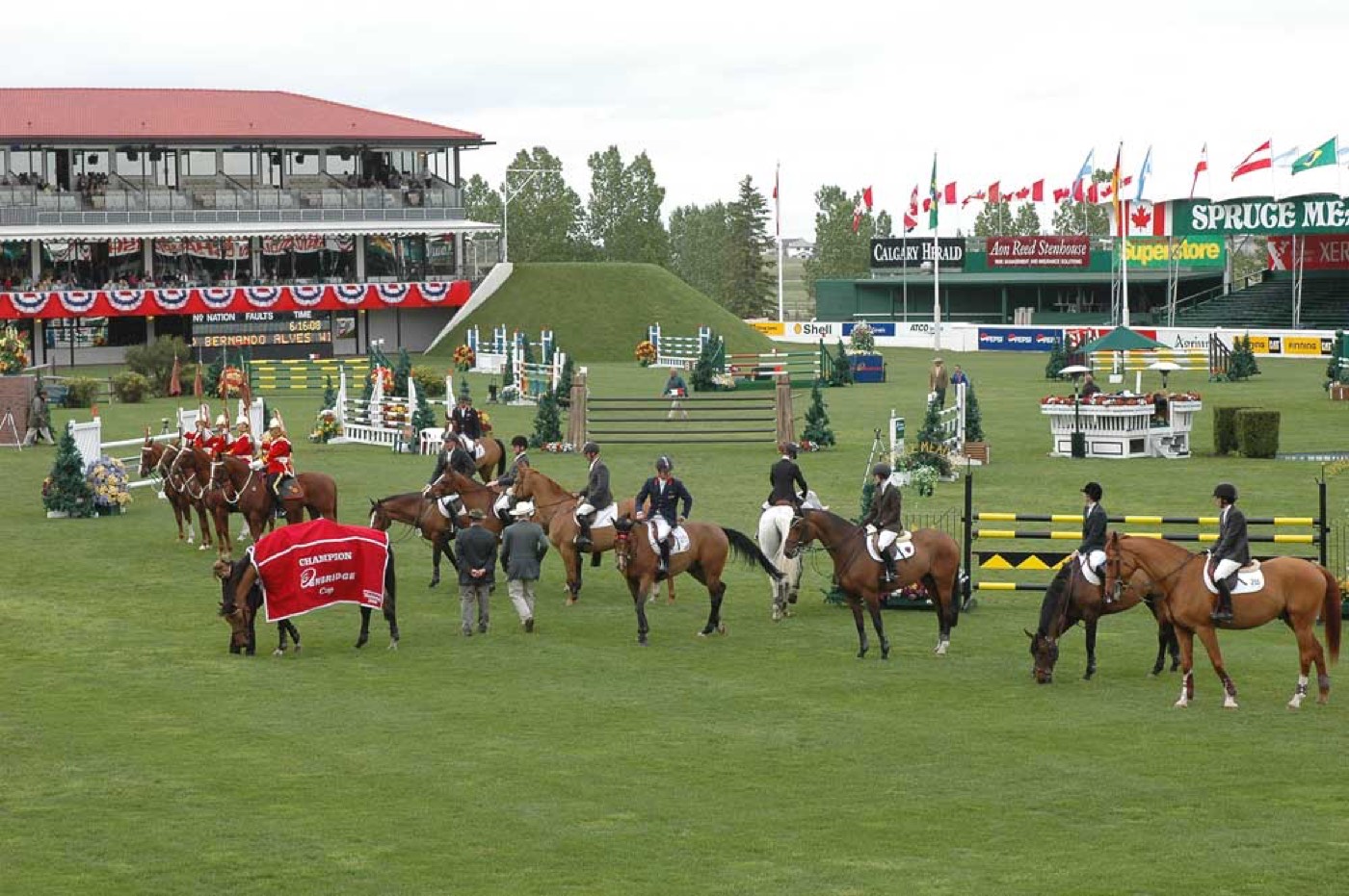
Spruce Meadows — one of the world's leading show-jumping venues — sits immediately west of Silverado, separated by a wetland buffer and environmental reserve the city required in 2004 before approving the community's construction. Paved pathways loop the reserve itself.


The resident's angle: tournament weekends mean real traffic on Sheriff King Street, several times a summer, in exchange for a world-class venue within walking distance of the western streets.
15 places, with real drive times
Road-adjusted distance and drive time from the centre of the community to each destination, nearest first. Filter by category.
Showing 1–12 of 15 places, nearest first.
Method: distances and drive times are estimated from the centre of the community to each destination using Calgary's road grid, and are rounded to honest ranges rather than presented as precise figures. Silverado Marketplace covers routine errands; anything larger means a drive north past Shawnessy.
Every gym within reach
Nothing inside the community matches a full-service facility yet. YMCA Shawnessy, twelve to sixteen minutes north, is the nearest anchor; the wetland pathway is the free option at the door.
- Small commercial fitness studios sit at the Shawnessy retail node, on the way
- Commercial gyms cluster further north around Southcentre Mall
- The environmental reserve pathway is the free option, right at the community's own edge
- Spruce Meadows itself is a spectator venue, not a public fitness facility
| Facility | What it is | Drive |
|---|---|---|
| YMCA Shawnessy open | Full-service YMCA with pool, gym and fitness classes, north in Shawnessy. | 12–16 min |
| Environmental reserve & wetland pathway open | Free option: paved paths loop the reserve at the community's own edge. | 1–2 min |
| Shawnessy Towne Centre studios open | Small commercial fitness studios at the Shawnessy retail node. | 11–15 min |
| Southcentre-area clubs open | Commercial gyms around Southcentre Mall. | 16–21 min |
The reserve does the daily work. The paved loop toward Spruce Meadows is what most residents actually use; the paid options exist for water and weights.
One school inside, already over capacity
Ron Southern School carries kindergarten through grade 6 inside the community, but enrolment has run ahead of the building since it opened in 2017. Harold Panabaker School, in neighbouring Southwood, carries grades 7 through 9.
| School | Board | Note |
|---|---|---|
| Ron Southern School | Calgary Board of Education | Public K–6 inside the community, opened 2017; enrolment has run ahead of the building since. |
| Harold Panabaker School | Calgary Board of Education | Public middle school in neighbouring Southwood; carries Silverado's grades 7–9. |
| All Saints High School | Calgary Catholic School District | Catholic senior high; its boundary covers the deep-south communities, Silverado included. |
| Catholic elementary designation | Calgary Catholic School District | CCSD has not published a stand-alone Silverado catchment; confirm directly for a specific address. |
Alberta funds Catholic education the same way it funds public education, so there is no tuition for a resident student at either board. Confirm current capacity and the designation for a specific address — CBE has already re-designated part of neighbouring Belmont away from Ron Southern once, and further changes are plausible as the deep south keeps building out.
Month by month, what living here looks like
Not a highlights reel — the actual annual rhythm, including the dates residents have to remember.
- The environmental reserve toward Spruce Meadows freezes into a still white gap between the houses and the show grounds
- Stoney Trail's open shoulder on the north edge catches wind that the inner blocks are spared
- Ron Southern School's kindergarten drop-off backs up some mornings — enrolment has run ahead of the building since it opened
- Spruce Meadows' grandstands sit empty and snow-covered, visible across the reserve from the community's western streets
- A chinook off Stoney Trail can bare the reserve pathway's snowpack within a single afternoon
- Silverado Marketplace's lot gets ploughed before most of the surrounding residential crescents
- The wetland's ice holds longest on its sheltered south corner, away from the open Stoney Trail wind
- Unheated show homes on the community's last unsold lots are the first to frost over each morning
- Freeze-thaw is harder on Silverado's driveways, most poured since 2005, than on older southwest streets
- Meltwater collects on the reserve's low ground before the storm system clears it
- Spruce Meadows' groundskeepers start prepping the show rings, visible working across the buffer
- Cleats help on the reserve's shaded switchbacks, where the sun doesn't reach until midday
- The wetland fills with returning waterfowl working the reeds toward Spruce Meadows
- Spruce Meadows posts its June dates as the show rings dry out across the reserve
- The community's newest edge lots, along 194 Avenue, are still landscaping bare yards this time of year
- Minor sports registration fills within days — a quarter of Silverado's residents are under 15
- Spectator traffic on Sheriff King Street builds ahead of Spruce Meadows' June tournaments
- The reserve pathway is at its greenest, reeds thick on both banks toward the show grounds
- Wind off the open land past Stoney Trail is sharper here than in communities set back from the city's edge
- Silverado's newest sod, laid within the last few years, is still establishing
- Spruce Meadows opens its summer tournaments just across the reserve — some residents can hear the announcer from their own yards
- School lets out and Ron Southern's playground stays busy well past the final bell
- With a quarter of the population under 15, Silverado's parks see more after-dinner traffic than most communities this size
- The reserve's cattails grow tall enough to screen the pathway from Sheriff King Street
- Spruce Meadows' mid-summer tournament runs close enough that traffic on Sheriff King Street builds for several days
- Stampede adds a long detour north for a community already at the far southern edge of the city
- Silverado catches more open-country wind on summer afternoons than communities set back from Stoney Trail
- The reserve's grasses reach full height, and the wetland smells like a wetland by midsummer
- Spruce Meadows sits quiet between its summer series and September's tournament, grandstands empty across the reserve
- The reserve pathway gets its last heavy use of the season before the school routine resets
- Kananaskis is the nearer trip from here, south past Spruce Meadows on Highway 22
- Back-to-school shopping at Silverado Marketplace runs heavier than the plaza's size would suggest, given how many young families live here
- Spruce Meadows' autumn tournament draws international fields visible right across the reserve from Silverado's western streets
- Ron Southern's halls fill past the numbers the school was designed for, a recurring September story here
- The wetland grasses turn gold and the season's first flocks stage before heading south
- Stoney Trail's morning commute overlaps with tournament traffic and the school run at once
- Spruce Meadows closes its outdoor season once the September crowds clear the grounds
- Poplar colour along the reserve peaks before Silverado's own street trees, most planted since 2005, catch up
- Wind off Stoney Trail strips the youngest trees bare faster than in more established communities
- The season's first snow tends to settle on the reserve's open ground before it sticks on the sheltered crescents
- Spruce Meadows sits closed and quiet, its grounds visible across the reserve from the wetland pathway
- The community's exposure at the city's southern edge makes the first real cold snap feel sharper than the forecast suggests
- The reserve ices over first on its sheltered corners, later on the stretch that faces Stoney Trail
- Holiday displays go up at Silverado Marketplace ahead of most neighbourhood streets
- A chinook off the open land past Stoney Trail can clear Silverado's roads faster than it clears more sheltered communities
- The reserve pathway becomes the community's quiet winter walk, ice on the wetland permitting
- Silverado's youngest street trees, planted since the mid-2000s build-out, still need staking against the winter wind
- With a quarter of residents under 15, the holiday break brings heavy use to the reserve pathway and the school playground alike
36 photographs of the community and its surroundings
All freely licensed and served from this app — nothing loads from a third party. Filter by category.







Showing 1–12 of 36 photographs.
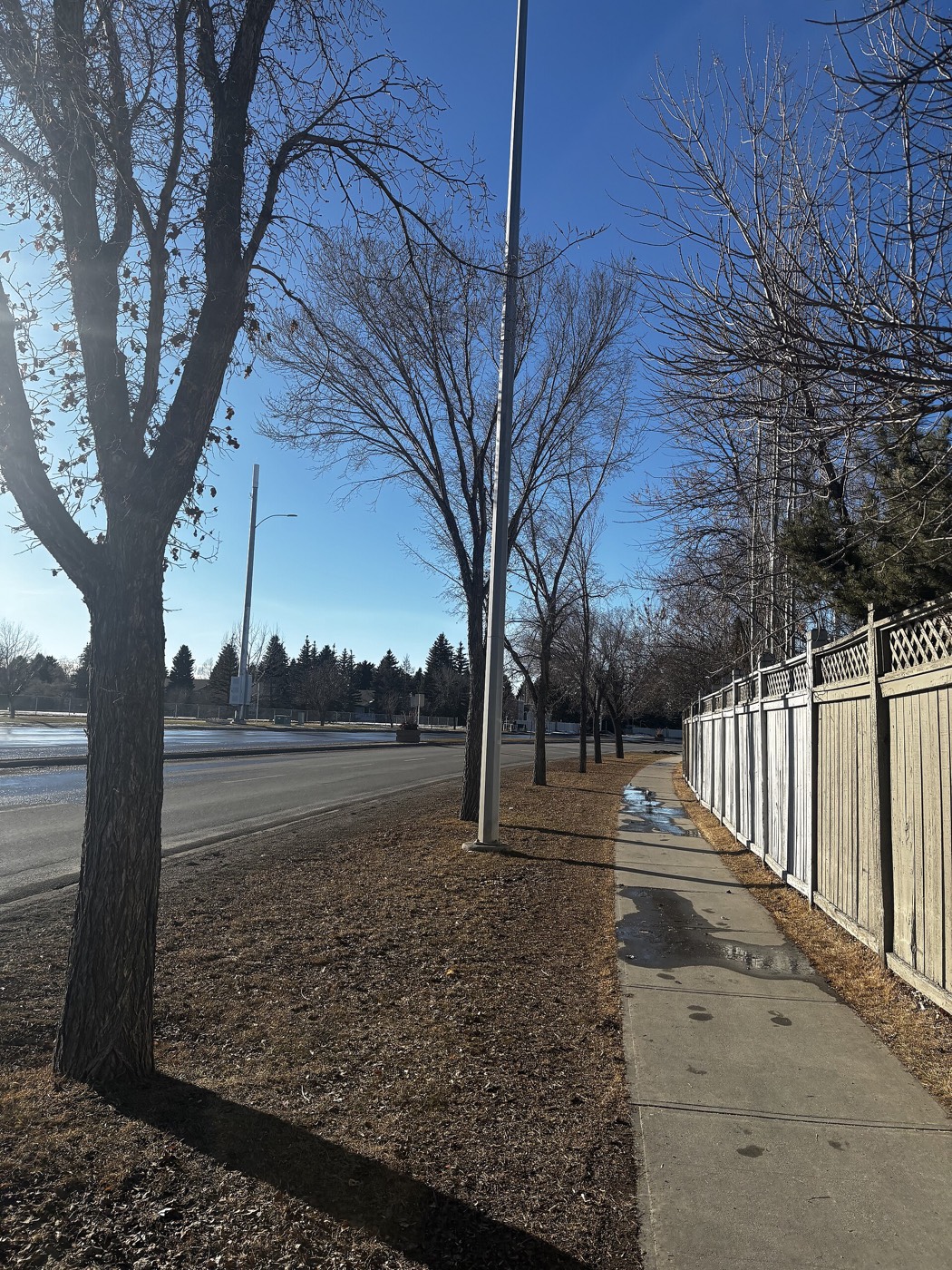
Honesty note. This page uses only the general Calgary, seasonal, Alberta-wildlife and day-trip photography from the site's shared library. Nothing here is presented as a photograph of Silverado itself.