
Live in Wesley Heights
A mile west of uptown on the Gold Line — a historic Black west-end neighborhood, a local historic district, and the sharpest illustration in Charlotte of what displacement actually looks like.
Wesley Heights sits a mile west of uptown, between the Historic West End's institutions and the rail corridor, and it is the neighborhood where Charlotte's arguments about who the city is for are least abstract. It was developed from the 1910s and became, after the demolition of Brooklyn in the 1960s and 1970s, part of the west side where displaced Black families moved and built. It has been a local historic district since the 1990s, which is why the bungalows on Grandin and Walnut are still standing. And since the CityLYNX Gold Line streetcar reached West Trade Street, prices here have moved faster in percentage terms than almost anywhere else in the city. If you buy here you are participating in that, and the neighborhood will tell you so — the land trusts, the church congregations and the community organisations on this side of town have been explicit about it for a decade.
A mile from uptown, and the sharpest version of Charlotte's argument with itself
West of uptown across I-77, between West Trade Street and the rail corridor, running out toward Biddleville and Johnson C. Smith University. Seversville and Biddleville sit north and west, Third Ward and uptown east across the interstate, and Wilmore south beyond the tracks.
Wesley Heights was laid out in the 1910s on the streetcar line west of the city, and filled with bungalows and foursquares on a compact grid. Its context is the Historic West End: the cluster of Black institutions anchored by Johnson C. Smith University, founded in 1867 as the Freedmen's College of North Carolina and still one of the country's historically Black universities.
What happened in between is the part that matters. When urban renewal cleared Brooklyn in Second Ward between 1960 and 1977 — some 1,480 structures and around ten thousand people — the displaced moved largely west and north, into these neighborhoods, which then absorbed decades of disinvestment. Then I-77 was built along the eastern edge, cutting the area off from an uptown a mile away.
And now the pressure has crossed back over. The Gold Line streetcar runs along West Trade Street, uptown's development has jumped the interstate, and prices here have risen faster in percentage terms than almost anywhere in Charlotte. The local historic district designation from the 1990s is why the bungalow streetscape survived to be desirable at all.
The honest version. If you buy here you are part of that story, and the neighborhood will say so plainly — community land trusts, church-led housing efforts and long-standing residents' associations on this side of the city have been explicit about displacement for a decade, and it is worth listening to them before you arrive. The practical notes are ordinary by comparison: 1920s stock with the usual wiring, insulation and plumbing questions; Irwin and Stewart Creeks, which give the west side more property in the flood plain than any other part of Charlotte; and stadium traffic across the interstate on seventeen-plus Sundays a year. The genuine advantages are the distance to uptown and, underrated, the six-mile airport run — the shortest of any neighborhood on this site.

- Community land trusts and church-led housing programmes operate on this side of the city — understand what is happening before you arrive, not after
- Check Irwin and Stewart Creeks on the flood map; the west side has more property in the 100-year flood plain than anywhere else in Charlotte
- Inside the local historic district, exterior work goes through design review — read the guidelines before planning a renovation
- 1920s stock: wiring, insulation, plumbing and foundations are the four things to price into an offer
- The airport is six miles away, which is the shortest run on this site and a real advantage if you travel
- Mecklenburg revalues 1 January 2027, and west-side percentage gains since 2023 have been among the steepest in the county
How Wesley Heights got here
- 1867Johnson C. Smith University is founded as the Freedmen's College of North Carolina, two years after the Civil War. It becomes the anchor of Charlotte's Historic West End and remains one of the country's historically Black colleges and universities.
- 1910s–1920sWesley Heights is laid out on the streetcar line west of the city, and fills with bungalows and foursquares on a compact grid.
- 1960s–1970sUrban renewal clears Brooklyn in Second Ward — around 1,480 structures and some ten thousand people — and the displaced move largely west and north. The west side's Black neighborhoods absorb the population and the disinvestment that followed.
- 1970s–1980sInterstate 77 is built along the eastern edge, cutting the neighborhood off from uptown as effectively as Independence Boulevard did in the east.
- 1990sWesley Heights is designated a local historic district, subjecting exterior work to design review — the reason its bungalow streetscape survived when others did not.
- 2010s–2020sThe Gold Line streetcar reaches West Trade Street, uptown's development pressure crosses the interstate, and prices rise faster here in percentage terms than in almost any other part of the city. Community land trusts and church-led housing efforts on the west side become a live part of the city's housing politics.
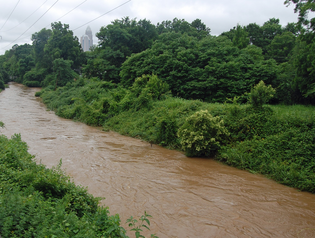
The green space is uptown's, for now
The Irwin Creek Greenway runs along the southern edge and is part of a west-side trail network that is genuinely improving and still incomplete. Otherwise the nearest substantial public space is across the interstate: Romare Bearden Park in Third Ward, named for the collagist who grew up on this side of the city, and the rest of uptown's parks beyond it.

The resident's angle: check which greenway segments are actually built near the address you are considering — the west-side network is expanding in pieces, and the published map is ahead of the ground. The same creeks that carry the greenway are the ones that flood.
16 places, with real drive times
Road-adjusted distance and drive time from the centre of the community to each destination, nearest first. Filter by category.
Showing 1–12 of 16 places, nearest first.
Method: distances and drive times are computed from a representative point near West Trade Street, using straight-line distance multiplied by a road factor and a tiered speed model — honest ranges, not routed times. I-77 is the local distortion: it makes uptown a three-minute drive and a much longer walk than a mile would suggest.
Every gym within reach
There is no large municipal facility inside the neighborhood. The Irwin Creek Greenway is the free option at the southern edge, and the nearest full-service pool and weight floor is the Dowd YMCA in Dilworth, on the far side of uptown.
- The nearest off-road route, and the west side's network is expanding in segments
- The Dowd YMCA in Dilworth is the nearest full-service pool and weight floor
- Uptown's parks and the Rail Trail are both a short drive or a Gold Line ride away
- Johnson C. Smith's facilities are for students and staff — do not count on them
| Facility | What it is | Drive |
|---|---|---|
| Irwin Creek Greenway open | The nearest off-road route, along Irwin Creek at the southern edge — part of a west-side greenway network that is still being connected. | 3–5 min |
| Dowd YMCA open | 400 East Morehead in Dilworth — the nearest full-service pool and weight floor, on the far side of uptown. | 7–11 min |
The free option is the greenway plus uptown's parks a mile east, which is a short trip on the streetcar and a genuinely walkable one on a good day.
West Charlotte High, and a district still working through its history
West Charlotte High School serves much of this side of the city and is among the most historically significant schools in the county — it was central to Charlotte's desegregation and to what happened after the courts stepped back. Johnson C. Smith University sits immediately northwest, and the Charlotte Lab School charter campuses are a short trip east.
| School | Board | Note |
|---|---|---|
| West Charlotte High School | CMS | The comprehensive high school for much of the west side, and one of the most historically significant in the county — it was central to Charlotte's desegregation and to what followed it. |
| Johnson C. Smith University | Post-secondary | Founded in 1867 as the Freedmen's College of North Carolina, and the institutional anchor of the Historic West End. |
| Charlotte Lab School | Public charter | A K-12 charter on two uptown campuses admitting by county-wide lottery — a short trip from here. |
| Central Piedmont Community College | Post-secondary | The main campus is on the far side of uptown on Elizabeth Avenue. |
| Charlotte-Mecklenburg Schools assignment | CMS | West-side elementary and middle assignment varies by address, and the district's magnet and assignment review is expected to change options from 2027. Check the specific address. |
West-side elementary and middle assignment varies by address. Check it in the CMS assignment lookup, and note the district's magnet and assignment review, which is expected to change options from 2027 — an issue this side of the city has particular reason to follow closely.
Month by month, what living here looks like
Not a highlights reel — the actual annual rhythm, including the dates residents have to remember.
- Highs around 10 °C; 1920s bungalows here have the same wiring and insulation questions as their equivalents in the east
- The slowest month for listings, and one of the few times to negotiate on this side
- The Gold Line runs a reduced holiday schedule into the first week
- The wettest stretch of winter, and Irwin Creek runs high
- Black History Month programming at Johnson C. Smith and the west-side institutions
- A good month to see a house's grading and drainage before the growth returns
- Pollen coats every porch across the Piedmont
- Spring listing season, and the west side's price movement is most visible in it
- The greenway segments dry out and fill up
- Mid-20s and dry, and the walk to uptown is genuinely pleasant if you take the Trade Street route
- Peak competition for renovated bungalows inside the historic district
- Johnson C. Smith's spring calendar fills the neighborhood's northern edge
- Humidity arrives in the last week and stays until late September
- Graduation at Johnson C. Smith is the west side's biggest weekend
- Charlotte FC evening matches put stadium traffic across the interstate
- Afternoon thunderstorms arrive fast; Irwin and Stewart Creeks are the west side's flood risk and they respond quickly
- Juneteenth events on this side of the city are the largest in Charlotte
- Cooling an uninsulated bungalow is the season's main expense
- The hottest month; canopy on this side is thinner than in Myers Park and the difference is measurable
- Fireworks uptown are visible from most of the neighborhood
- The greenway is the only shaded route out
- Schools return in late August and the university term restarts
- The slowest month of the housing market and the best month to negotiate
- Panthers pre-season brings stadium traffic back across the interstate
- Home game Sundays across I-77 affect parking and access on the eastern blocks
- Hurricane remnants reach the Piedmont as rain and wind
- Irwin Creek's flood plain is the thing to check before buying anything low-lying
- Dry, mid-20s, and the best walking weather of the year
- Homecoming at Johnson C. Smith is the neighborhood's biggest event
- Peak colour arrives in early November
- Listings thin and negotiation gets easier
- The canopy turns and drops on the older streets
- Thanksgiving empties both the university and the roads
- Uptown's holiday season is a mile away and visible from most of the neighborhood
- Highs around 12 °C — mild by any northern standard
- The last window to close before 1 January, which matters more than usual before the 2027 revaluation
20 photographs of Charlotte and the region
Drawn from the site's shared, freely licensed Charlotte photo library — not photographs of Wesley Heights itself. Filter by category.


Showing 1–12 of 20 photographs.
About these photographs. Openly licensed images geotagged in or near Wesley Heights, found on Wikimedia Commons and served from there with full attribution. Inline photos elsewhere on the page may still come from the site's shared Charlotte library.