
Live in Wilmore
Mill houses between South End and the Gold Line — the last cheap address inside the inner belt, and no longer cheap.
Wilmore is the mill neighborhood on the other side of South Boulevard from South End: small houses on small lots, built from the 1900s for the workers at the Atherton Mill and the plants along the rail corridor, on a grid a mile from uptown. For most of the twentieth century it was working-class and, after the mills went, overlooked. What changed it is entirely a matter of geography — it is inside the I-277 loop's reach, it borders the densest new construction in the Carolinas, and it has the housing stock that South End itself lost. The result is that a 1,100-square-foot mill cottage in Wilmore now costs what a four-bedroom in the outer suburbs does. It is small, it is walkable, it is the closest thing left to an ordinary old house near the centre of Charlotte, and the arguments about what that has done to the people who lived here are not settled.
The mill housing that South End lost, on the other side of the boulevard
South-west of uptown between South Boulevard and West Boulevard, with the rail corridor and South End on the eastern side and the Wilmore Centennial Park at the middle. Dilworth sits east across the tracks, Sedgefield south, and the Historic West End and Wesley Heights north across the interstate.
Wilmore was built from the 1900s as housing for the mills and plants along the rail corridor — small cottages on small lots, on a grid, within walking distance of the work. That is the same corridor that is now the Blue Line, and the same mill — Atherton, 1893 — that is now shops and a Saturday market. What separates Wilmore from South End is one road.
Which turns out to be the whole story. South End replaced almost all of its old housing with apartment blocks; Wilmore kept its. So when the corridor became desirable, the buyers who wanted an old house near the centre had exactly one place to go. A 1,100-square-foot mill cottage here now sells for what a four-bedroom does in the outer suburbs, and Wilmore's median has passed half a million dollars for houses built on mill wages.
What is inside the walk. Uptown, a mile northeast and a genuinely walkable one. The Rail Trail and everything on it, across South Boulevard. Atherton Mill, the East/West Boulevard station, the hospital in Dilworth two miles east, and the airport seven miles west — one of the shorter runs on this site.
The honest version. The houses are small and old: 1900s to 1920s cottages, often on shallow foundations, with wiring and plumbing that have usually been redone at least once. Lots are small enough that an addition is a design problem rather than a decision. South End's noise carries across the boulevard on still evenings and stadium Sundays affect the northern blocks. And, as on the rest of this side of the city, the price history has a displacement story behind it that is worth understanding rather than skipping.

- 1900s–1920s cottages: foundations, wiring, plumbing and insulation are the four things to price into an offer
- Lots are small — check what an addition would actually be permitted to do before assuming you can grow into the house
- Noise from South End carries on still evenings, and stadium Sundays affect the northern blocks
- Check Irwin Creek on the flood map for anything on the low north-western side
- The nearest Blue Line station is across South Boulevard — a genuinely walkable distance, but check the crossing you would actually use
- Mecklenburg revalues 1 January 2027, and this is one of the fastest-appreciating small areas in the county since 2023
How Wilmore got here
- 1900s–1920sWilmore is developed as housing for workers at the Atherton Mill and the industry along the rail corridor: small cottages on small lots, laid out on a grid within walking distance of the work.
- 1930s–1970sA steady working-class neighborhood. The mills wind down through the middle of the century and the industrial jobs on this side of the tracks go with them.
- 1980s–1990sDisinvestment, and prices low enough that Wilmore is one of the cheapest addresses inside the inner belt — a condition that lasts long enough to feel permanent.
- 2007The Blue Line opens along South Boulevard. Wilmore is on the wrong side of the road for a station, and on exactly the right side of it for the land values that follow.
- 2010sSouth End's apartment boom reaches the boundary. Wilmore's cottages — small, old, and near everything — become the thing buyers cannot get in South End, and prices move accordingly.
- 2020sInfill and renovation continue on almost every block, and Wilmore's median sale price passes half a million dollars for houses that were built for mill wages.
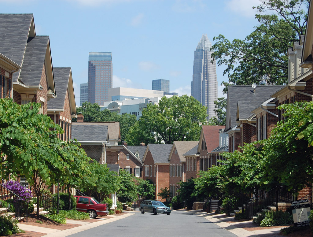
Borrowed green space, and it works
Wilmore has little public open space of its own; what it has is proximity. The Rail Trail — 3.5 miles of lit, paved linear park with outdoor exercise equipment — is a fifteen-minute walk across South Boulevard, the Irwin Creek Greenway runs to the northwest, and Freedom Park is three miles southeast.

The resident's angle: borrowing South End's park works well and costs nothing, but check the crossing. South Boulevard is a real road, and which intersection you would use on foot at night is a reasonable thing to test before you buy.
17 places, with real drive times
Road-adjusted distance and drive time from the centre of the community to each destination, nearest first. Filter by category.
Showing 1–12 of 17 places, nearest first.
Method: distances and drive times are computed from a representative point near West Boulevard, using straight-line distance multiplied by a road factor and a tiered speed model — honest ranges, not routed times. As in the rest of the inner ring, the drive column undersells the neighborhood: uptown, the station and the trail are all walks.
Every gym within reach
The free option is the Rail Trail across the boulevard, with outdoor exercise stations along its length. For a pool and a full weight floor, the Dowd YMCA in Dilworth is two miles east, and the studios of South End are closer than that.
- Free, flat, lit and busy at all hours — the reason a lot of this neighborhood has no gym membership
- The Dowd YMCA in Dilworth is the nearest full-service pool and weight floor
- South End's boutique studios are a short walk across the boulevard
- The Irwin Creek Greenway to the northwest is the quieter off-road option
| Facility | What it is | Drive |
|---|---|---|
| Charlotte Rail Trail open | Across South Boulevard: 3.5 miles of lit, paved linear park with outdoor exercise equipment — the free option, and the one most of the neighborhood uses. | 3–5 min |
| Dowd YMCA open | 400 East Morehead in Dilworth — the nearest full-service pool and weight floor. | 6–9 min |
The free option is the trail, and it is a good one — with the same caveat about the South Boulevard crossing that applies to everything else on this page.
Two campuses and a boundary that ignores the neighborhood
Dilworth Elementary runs on two campuses — Latta and Sedgefield — and the Sedgefield campus is the closer of the two to Wilmore, though which campus and which grades an address feeds is a matter of the assignment rather than the distance. Sedgefield Middle is immediately south, and Myers Park High is the usual high school assignment for much of this area.
| School | Board | Note |
|---|---|---|
| Dilworth Elementary School | CMS | Operates on two campuses, Latta and Sedgefield; the Sedgefield campus is the closer one to Wilmore. Which campus and which grades depend on the address. |
| Sedgefield Middle School | CMS | The usual middle assignment for this part of the city, immediately south on Dorchester Place. |
| Myers Park High School | CMS | The usual high school assignment for much of this area, though the boundary does not follow neighborhood lines. |
| Charlotte Lab School | Public charter | A K-12 charter on two uptown campuses admitting by county-wide lottery — a short trip from here. |
| Central Piedmont Community College | Post-secondary | The main campus is on Elizabeth Avenue on the far side of uptown. |
The boundaries here do not follow the neighborhood lines. Check the address in the CMS assignment lookup, and note the district's magnet and assignment review, which is expected to change options from 2027.
Month by month, what living here looks like
Not a highlights reel — the actual annual rhythm, including the dates residents have to remember.
- Highs around 10 °C; small old houses are cheap to heat only if somebody has already insulated them
- The slowest month for listings and the best month to negotiate
- The Rail Trail across the boulevard is empty enough to enjoy
- The wettest stretch of the winter; Irwin Creek runs high to the northwest
- A good month to inspect a 1910s cottage — crawlspaces, grading and foundations are all visible
- Charlotte FC pre-season starts and stadium traffic resumes
- Pollen coats every porch
- Spring listing season, and Wilmore's small stock moves within days when it moves
- Patios reopen across the boulevard in South End
- Mid-20s and dry, and the walk to uptown is genuinely pleasant
- Peak competition for renovated cottages
- The Rail Trail is busy from seven in the morning
- Humidity arrives at the end of the month
- South End's evening noise carries across South Boulevard on still nights
- Charlotte FC matches fill the stadium and the streets north of here
- Afternoon thunderstorms arrive fast; the tree canopy here is patchier than in Dilworth
- Cooling a small uninsulated cottage is the season's main expense
- The Rail Trail's shade is thin — mornings and evenings only
- The hottest month, and the one where old-house upgrades pay for themselves
- Fireworks uptown are visible from the northern blocks
- The neighborhood empties on weekends toward the lake
- Schools return in late August; the Sedgefield campus run is the local traffic event
- The slowest month of the housing market and the best month to negotiate
- Panthers pre-season brings the stadium crowds back
- Home game Sundays affect parking and access on the northern blocks
- Hurricane remnants reach the Piedmont as rain and wind
- Irwin Creek's flood plain is the thing to check before buying anything low-lying
- Dry, mid-20s, and the best walking weather of the year
- South End's festival season spills across the boulevard
- Peak colour arrives in early November
- Listings thin and negotiation gets easier
- The canopy turns and drops on the older streets
- Thanksgiving empties the neighborhood for four days
- The Rail Trail's light installations are a short walk away and pull the city in
- Highs around 12 °C — mild by any northern standard
- The last window to close before 1 January, which matters more than usual before the 2027 revaluation
20 photographs of Charlotte and the region
Drawn from the site's shared, freely licensed Charlotte photo library — not photographs of Wilmore itself. Filter by category.


Showing 1–12 of 20 photographs.
About these photographs. Openly licensed images geotagged in or near Wilmore, found on Wikimedia Commons and served from there with full attribution. Inline photos elsewhere on the page may still come from the site's shared Charlotte library.