
Live in Eastland
The Central Avenue and Albemarle Road corridor — the most linguistically diverse blocks in the Carolinas, the cheapest housing inside I-485, and a dead mall site the city spent fifteen years arguing over.
Eastland is a mall that no longer exists and the neighborhoods that were built around it. The mall opened in 1975, anchored east Charlotte for two decades, declined through the 2000s, closed in 2010 and was demolished in 2013 — after which the site sat empty while the city cycled through proposals for it. What grew instead, along Central Avenue and Albemarle Road, is the most interesting food and business corridor in the Carolinas: Vietnamese, Salvadoran, Mexican, Ethiopian, Cambodian and Indian businesses in strip malls that nobody would photograph, serving a population that includes a large share of Charlotte's foreign-born residents. The housing is 1960s and 1970s ranch and split-level, and it is the cheapest anything inside I-485. What happens next is being decided now: Eastland Yards is finally under construction, and the City is subsidising retail rents on the site specifically so that small and immigrant-owned businesses can be part of it.
A demolished mall, a corridor of immigrant businesses, and a rebuild with the rent written down
East Charlotte around the Central Avenue and Albemarle Road corridors, from Eastway Drive out toward Idlewild and the I-485 loop. The old Eastland Mall site sits at Central and Sharon Amity; Plaza Midwood is inside it to the west, and the county line and Mint Hill are beyond it to the east.
Eastland Mall opened in 1975 with an ice rink in the middle and anchored the whole east side for twenty years. Retail moved outward, the mall declined, it closed in 2010 and came down in 2013. Then the site sat empty for a decade while proposal after proposal — a film studio, a soccer facility, a village — was announced and abandoned. For anyone reading east Charlotte's reputation from the outside, that empty lot did most of the work.
What actually happened on the corridor is more interesting. Because the housing stayed cheap, Central Avenue and Albemarle Road became where new immigrant communities could afford to open businesses. The result is the most linguistically diverse stretch in the Carolinas and, by a distance, the best food in the city — Vietnamese, Salvadoran, Mexican, Ethiopian, Cambodian and Indian, in strip malls nobody photographs.
Eastland Yards is finally real. Seventy-eight acres: more than 400 homes, 16,000 square feet of retail, an indoor sports and esports venue that broke ground in 2026, and a 4.5-acre public park due to open in spring 2027. The detail worth knowing is the rent. The City is acting as the middleman — paying the developer $39.70 a square foot and subleasing to small and minority-owned businesses at $22.00 — specifically so the businesses already in the corridor are not priced out of the thing built to celebrate them. The first four tenants were approved in January 2026.
The honest version. This is the cheapest housing inside I-485 and the reasons are real: the schools here are assigned block by block and are not the county's strongest on paper, the tree canopy is thinner than inner-ring neighborhoods, the commute is Independence Boulevard or Central Avenue, and there is no rail — the Silver Line that would run out this way has no funded date. The stock is 1960s and 1970s ranch and split-level: cheap to buy, and dependent on windows, insulation and duct work for whether it is cheap to run. What you are betting on is a corridor with real public investment behind it for the first time in fifty years.
- No rail: the Silver Line that would serve this corridor is unfunded, and Independence Boulevard is the commute
- School assignment varies block by block more than anywhere else in the county — check the address, twice
- 1960s–70s ranch and split-level: windows, insulation and duct work decide whether cheap to buy means cheap to run
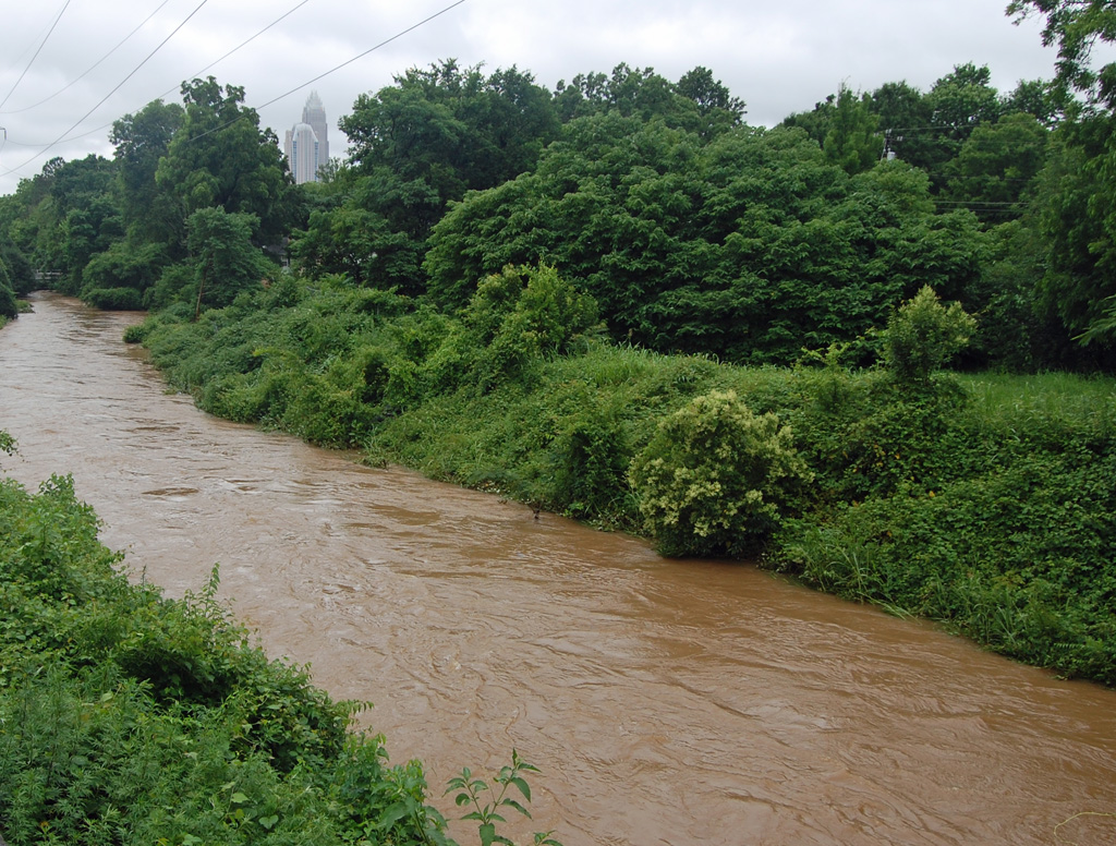
- Check Briar Creek and McAlpine Creek on the flood map for anything low-lying
- Eastland Yards' park is due spring 2027 and the sports venue after it — buying near it is a bet on delivery, and this site has a history of delay
- Mecklenburg revalues 1 January 2027; corridors with new public investment are where assessments move most sharply
How Eastland got here
- 1960s–1970sEast Charlotte fills with ranch and split-level subdivisions along Central Avenue and Albemarle Road, aimed at the same buyers the south side was competing for.
- 1975Eastland Mall opens, with an ice rink at its centre, and becomes the retail and social anchor of the entire east side for the best part of two decades.
- 1990s–2000sRetail moves outward to newer centres, the mall declines, and east Charlotte's housing stays cheap — which is precisely why it becomes the part of the city where new immigrant communities can afford to start businesses.
- 2010–2013The mall closes and is demolished. The City acquires the site, and it stands empty through a decade of proposals: a film studio, a soccer facility, a mixed-use village, each announced and each abandoned.
- 2020sThe City designates Albemarle Road and Central Avenue as one of its Corridors of Opportunity, directing infrastructure and small-business investment into the corridor rather than only into the mall site.
- 2025–2027Eastland Yards finally goes up: 78 acres with more than 400 homes, 16,000 square feet of retail, an indoor sports and esports venue breaking ground in 2026, and a 4.5-acre public park due to open in spring 2027. The City subleases the retail below market — $22 a square foot against the $39.70 it pays — so the businesses already in the corridor can afford to be in it.

Reedy Creek does the work until Eastland Yards opens
Reedy Creek Park and Nature Preserve — nearly a thousand acres with lakes, playing fields and about ten miles of trail — is the best outdoor facility on this side of the county and the corridor's real green space. Inside the neighborhood, the 4.5-acre park at Eastland Yards broke ground in October 2025 and is due to open in spring 2027, which will be the first significant new public space here in decades.


The resident's angle: east Charlotte's green space is large and far apart rather than small and close, which is the opposite of the inner-ring neighborhoods. If walkable park access matters, look at how close a specific address is to the Eastland Yards site — and treat the 2027 date as a plan rather than a promise, given the site's history.
17 places, with real drive times
Road-adjusted distance and drive time from the centre of the community to each destination, nearest first. Filter by category.
Showing 1–12 of 17 places, nearest first.
Method: distances and drive times are computed from a representative point near Central Avenue and the old mall site, using straight-line distance multiplied by a road factor and a tiered speed model — honest ranges, not routed times. Independence Boulevard is the exception that matters: it is the commute for most of this corridor and it does not behave like a road of its size at peak.
Every gym within reach
The free options here are county ones and they are good but not close: Reedy Creek Park and Nature Preserve to the northeast has ten miles of trail, lakes and fields. Inside the corridor, the commercial gyms sit in the shopping centres, and the indoor sports and esports venue at Eastland Yards is under construction.
- About ten miles of trail, plus lakes and fields, and free
- Eastland Yards' indoor sports and esports venue broke ground in 2026
- Commercial gyms are in the corridor's shopping centres rather than standalone
- The nearest full-service YMCA pools are west of here toward uptown
| Facility | What it is | Drive |
|---|---|---|
| Reedy Creek Park and Nature Preserve open | Nearly a thousand acres with ten miles of trail, lakes and playing fields — the free option, and the best outdoor facility on this side of the county. | 10–15 min |
| Eastland Yards open | The indoor sports and esports venue on the old mall site broke ground in 2026; the 4.5-acre park beside it is due to open in spring 2027. | 2–3 min |
The free option is Reedy Creek, and it is genuinely a good one — but it is a ten-to-fifteen-minute drive rather than a walk, which is the pattern for this whole side of the city.
Assigned block by block
East Charlotte splits between Garinger High on Eastway Drive — organised into smaller academies, and one of the most diverse schools in the district by language and country of origin — and East Mecklenburg High on Monroe Road. Eastway Middle and several elementaries including Winterfield serve the corridor, and the boundaries between them do not follow anything a newcomer would guess.
| School | Board | Note |
|---|---|---|
| Garinger High School | CMS | On Eastway Drive, serving much of east Charlotte and organised into several smaller academies. It is one of the district's most diverse schools by language and country of origin. |
| East Mecklenburg High School | CMS | The other comprehensive high school on this side, on Monroe Road. Which of the two an address feeds depends on the block. |
| Eastway Middle School | CMS | One of the middle schools serving the corridor, on Kilborne Drive. |
| Winterfield Elementary School | CMS | One of several elementaries along the corridor. Assignment in east Charlotte varies more block by block than anywhere else in the county. |
| Central Piedmont Community College | Post-secondary | The main campus is on Elizabeth Avenue and the Levine campus is in Matthews — between them the most-used post-secondary route for households in this corridor. |
Of the sixteen neighborhoods on this site, this is the one where assignment varies most within a short distance. Check the address in the CMS assignment lookup before you make an offer — and if you are buying for a child who will start after 2027, look at what the district's magnet and assignment review proposes for east Charlotte specifically.
Month by month, what living here looks like
Not a highlights reel — the actual annual rhythm, including the dates residents have to remember.
- Highs around 10 °C; 1960s and 1970s houses here are cheap to buy and expensive to heat without upgrades
- The slowest month for listings, and the corridor's best months for negotiating
- Lunar New Year preparations start along Central Avenue toward the end of the month
- The corridor's biggest cultural event, with celebrations along Central Avenue and at the Asian business centres
- The wettest stretch of winter, and a good month to check grading and drainage on a lot
- Construction on Eastland Yards continues through the winter
- Pollen coats everything, as it does across the Piedmont
- Spring listing season, and the corridor's price gap against the south side is at its most visible
- Reedy Creek's trails dry out and fill up
- Mid-20s and dry; the outdoor markets and festivals along the corridor start
- Peak season for the corridor's food festivals, which are the best introduction to east Charlotte there is
- Reedy Creek and the county parks are at capacity on weekends
- Humidity arrives in the last week and stays until late September
- School-year events at Garinger and East Meck put traffic on Eastway and Monroe
- Construction season on the corridor's infrastructure projects begins in earnest
- Afternoon thunderstorms arrive fast and clear inside an hour
- Tree cover here is thinner than in the inner-ring neighborhoods and the heat shows it
- Cooling a 1970s house with original ducts is the summer's main expense
- The hottest month; shade is scarce along the commercial corridor and plentiful in the older subdivisions
- Reedy Creek's lakes and shaded trail are where the neighborhood goes
- Insulation and duct work are the two questions to put to a seller
- Schools return in late August; Eastway and Central get materially busier
- The slowest month of the housing market and the best month to negotiate
- Hurricane season is under way even this far inland
- Hurricane remnants reach the Piedmont as rain and wind
- Briar Creek and McAlpine Creek flooding are the risks on low-lying parcels
- Friday night football at Garinger and East Meck is the corridor's weekly event
- Dry, mid-20s, and the corridor's festivals return
- Autumn listing season is smaller than spring, with less competition
- Reedy Creek's hardwoods turn in the last week
- Peak leaf colour arrives in the first week
- Listings thin and negotiation gets easier
- Thanksgiving is the corridor's busiest week for the grocers
- Highs around 12 °C — mild by any northern standard
- The corridor's retail carries the month; Eastland Yards' construction pauses over the holidays
- The last window to close before 1 January, which matters more than usual before the 2027 revaluation
20 photographs of Charlotte and the region
Drawn from the site's shared, freely licensed Charlotte photo library — not photographs of Eastland itself. Filter by category.


Showing 1–12 of 20 photographs.
About these photographs. Openly licensed images geotagged in or near Eastland, found on Wikimedia Commons and served from there with full attribution. Inline photos elsewhere on the page may still come from the site's shared Charlotte library.