Live in Plaza Midwood
Bungalows, dive bars and the fastest-changing blocks in the city — a 1910 streetcar suburb sitting where east Charlotte's immigrant business corridor begins.
Plaza Midwood was laid out in 1910 as Chatham Estates, with a trolley running out Central Avenue to sell the lots, and it spent most of the twentieth century as an ordinary working- and middle-class neighborhood of bungalows. What it became instead, from roughly 2000 onward, is the place people mean when they say Charlotte has changed. The bars on Central Avenue stayed weird longer than anyone expected and then the money arrived anyway: a 1,200-square-foot 1925 bungalow here now trades for more than a new four-bedroom in Ballantyne. Part of the neighborhood — The Plaza, Thomas Avenue and stretches of Pecan and Clement — was designated a local historic district in 1992, which is why those streets still look like themselves while blocks a few hundred feet away are being replaced. It is the most walkable non-uptown address in Charlotte and the one with the sharpest gap between what it was and what it costs.
A 1910 trolley suburb that became the argument about Charlotte
East of uptown between Central Avenue and The Plaza, running from the Belmont edge near Hawthorne out to Eastway Drive, with Midwood Park and Veterans Park inside it. Elizabeth sits to the south, NoDa to the north across the tracks, and the Central Avenue corridor continues east into the more diverse and less expensive blocks around Eastland.
It opened in 1910 as Chatham Estates, with a trolley line down Central Avenue built to carry buyers out to the lots — the same trick Latta had used in Dilworth twenty years earlier. Bungalows and foursquares filled the grid through the 1920s and 1930s, Central Avenue became the commercial street, and then the neighborhood spent fifty years being unremarkable while Charlotte's money went southeast instead.
What changed is not complicated. The bars and restaurants on Central and Thomas made the place a destination in the 2000s, and the prices followed: a 1,200-square-foot 1925 bungalow here now sells for more than a new four-bedroom in Ballantyne. In 1992 the core streets — The Plaza, Thomas Avenue and parts of Pecan and Clement — were designated a local historic district, which is why those blocks still look like themselves while streets a few hundred feet outside the boundary are being torn down and rebuilt at twice the scale.
What is inside the walk. Most of the reason to be here: the Central Avenue and Thomas Avenue strips, Veterans Park with its recreation centre and pool, the Little Sugar Creek Greenway at the western edge, and uptown a mile and a half away — genuinely walkable, if you do not mind the hill. East of here, Central Avenue keeps going into the most linguistically diverse blocks in the Carolinas, which is where the neighborhood's best food actually is.
The honest version. Three things. The noise: Central and Thomas are a going concern from Thursday to Sunday, and the difference between a house two streets back and one on the strip is real. The stock: 1920s bungalows on small lots with knob-and-tube, unlined chimneys and uninsulated attics, and the price per square foot is now high enough that renovation economics are unforgiving. And the boundary: whether an address sits inside the 1992 historic district determines both what you may do to it and what will be built next door — check the map, not the neighborhood name.

- Inside the 1992 district, exterior work goes through the Historic District Commission; outside it, the lot next door can be replaced with a house twice the size
- 1920s bungalow stock: wiring, chimneys, attic insulation and duct work are the four line items to price into an offer
- Noise is not incidental — stand on the porch on a Saturday evening before you sign anything within two streets of Central or Thomas
- High school assignment varies block by block on this side of the city; check the address with CMS rather than assuming
- No light rail: the Gold Line stops short of the neighborhood and the Silver Line is unfunded
- Mecklenburg revalues 1 January 2027, and few areas have run further ahead of their 2023 assessment than this one
How Plaza Midwood got here
- 1910The Chatham Estates development opens east of the city, with a trolley line down Central Avenue built to carry buyers out to the lots — the same technique Latta used in Dilworth twenty years earlier.
- 1910s–1930sBungalows, foursquares and a few larger houses on The Plaza fill the grid, and Central Avenue becomes the commercial street. The neighborhood is annexed into the city as it builds out.
- 1940s–1980sA steady, unglamorous middle-class neighborhood. Charlotte's growth runs southeast instead, and the east side is where housing stays cheap.
- 1992The core streets — The Plaza, Thomas Avenue, and parts of Pecan and Clement — are designated a local historic district, subjecting exterior work there to design review.
- 2000sThe bars, restaurants and shops on Central and Thomas turn the neighborhood into a destination. Prices start moving well ahead of the city average, and the arguments about who the change is for begin.
- 2010s–2020sRedevelopment reaches the edges: apartment blocks on Central and Hawthorne, and teardowns on any street outside the historic district. The Gold Line streetcar's second phase opens in 2021 and stops just short of the neighborhood, which is a recurring local complaint.

Veterans Park does the work
Veterans Park on Central Avenue is the county facility inside the neighborhood — a recreation centre, courts and a seasonal pool. The Little Sugar Creek Greenway runs along the western edge, paved and off-road, reaching uptown in one direction and Freedom Park in the other. Just south, Independence Park — Charlotte's first public park, opened in 1905 — has the tennis courts and the mature trees.

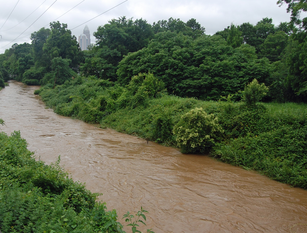
The resident's angle: this is one of the few Charlotte neighborhoods where the park, the greenway and the shops are all a walk rather than a drive. The catch is the creek: the low edges flood, and the greenway's existence there is partly a consequence of that. Check the flood map for anything near the western or southern boundary.
17 places, with real drive times
Road-adjusted distance and drive time from the centre of the community to each destination, nearest first. Filter by category.
Showing 1–12 of 17 places, nearest first.
Method: distances and drive times are computed from a representative point near Central Avenue and The Plaza, using straight-line distance multiplied by a road factor and a tiered speed model — honest ranges, not routed times. The uptown figure understates how walkable this neighborhood is and overstates how quick the drive is at 8am, when Central backs up from Hawthorne.
Every gym within reach
The neighborhood's own facility is Veterans Park, a county recreation centre on Central Avenue with a gymnasium, courts and a seasonal pool — by a distance the cheapest option here. Beyond it there are boutique studios along Central and Thomas, and the greenway.
- County pricing rather than studio pricing, inside the neighborhood
- Boutique studios cluster along Central and Thomas; expect Plaza Midwood prices
- The Little Sugar Creek Greenway is the free long route, off-road to uptown or Freedom Park
- The Dowd YMCA in Dilworth is the nearest full-size indoor pool
| Facility | What it is | Drive |
|---|---|---|
| Veterans Park open | The county recreation centre on Central Avenue, with a gymnasium, courts and a seasonal pool — the neighborhood's own facility and the cheapest option by a distance. | 3–5 min |
| Little Sugar Creek Greenway open | The free long route: paved and off-road, reaching uptown north and Freedom Park south. | — |
The free option is the greenway, plus the neighborhood itself — a continuous sidewalk grid with shade, which is rarer in Charlotte than it should be.
Magnets nearby, assignment by address
The two schools closest to Plaza Midwood are application programmes rather than neighborhood assignments: Piedmont Open IB Middle on East 10th Street and Elizabeth Traditional Elementary on Park Drive both admit by application. The home-school assignment for a specific address is a separate question, and on this side of the city it varies more block by block than anywhere else on this site — Garinger High on Eastway Drive serves much of east Charlotte, but not every Plaza Midwood block.
| School | Board | Note |
|---|---|---|
| Piedmont Open IB Middle School | CMS | A magnet middle school on East 10th Street admitting by application rather than by address — a common route for families here, and not a home-school assignment. |
| Elizabeth Traditional Elementary School | CMS | The nearest traditional-programme elementary, on Park Drive in Elizabeth. Traditional schools in CMS are application programmes rather than neighborhood assignments. |
| Garinger High School | CMS | The comprehensive high school on Eastway Drive serving much of east Charlotte. High school assignment differs block by block here more than in any other neighborhood on this site. |
| Central Piedmont Community College | Post-secondary | The main campus is a mile southwest on Elizabeth Avenue, with trades, nursing and university transfer programmes. |
| Charlotte Lab School | Public charter | A K-12 charter on two uptown campuses, admitting by county-wide lottery — the common alternative for families in the inner east side. |
Do not take a listing's school claim at face value here. Check the address in the CMS assignment lookup, and if you are relying on a magnet, check the lottery timeline as well — the district has a magnet and assignment review under way expected to change options from 2027.
Month by month, what living here looks like
Not a highlights reel — the actual annual rhythm, including the dates residents have to remember.
- Highs around 10 °C; the bungalow stock is where the winter heating bill shows up
- The slowest month for listings, and one of the few times a bungalow here is negotiable
- Snow closes Central Avenue's hill for a day or two most years
- The wettest stretch of winter, and the easiest month to see a roofline and a foundation clearly
- Historic District Commission agendas are worth reading if you are buying inside the 1992 boundary
- The bars are quiet enough to be pleasant on a weeknight
- Dogwoods, azaleas and a pollen count that coats every porch
- Patios reopen and Central Avenue gets loud again from Thursday
- Spring listing season; the best bungalows go under contract within days
- Mid-20s and dry, and the neighborhood is at its most walkable
- Veterans Park fills up and the greenway is busy from seven
- Peak competition for anything renovated inside the historic district
- Humidity arrives in the last week and stays until late September
- Street festivals and markets run along Central through the spring
- The tree canopy closes in and the older streets get noticeably cooler than the new blocks
- Afternoon thunderstorms arrive fast; mature oaks over 1920s roofs make limb damage an annual risk
- The bar patios carry the evening and the noise question becomes real for anything near Central or Thomas
- Cooling an uninsulated bungalow attic is the summer's main expense
- The hottest month; the canopy on the older streets is worth several degrees
- Fourth of July fireworks uptown are visible from the western blocks
- The greenway is the only comfortable route between noon and five
- Schools return in late August and Central Avenue's morning traffic doubles
- The slowest month of the housing market and the best month to negotiate
- Magnet and charter lottery timelines start being discussed for the following year
- Hurricane remnants reach the Piedmont as rain and wind
- Briar Creek and Little Sugar Creek flooding are the risks on the low edges of the neighborhood
- Evenings drop into the low 20s and the patios refill
- Dry and mid-20s; the best month of the year here by a distance
- Street festivals and the neighborhood's Halloween, which is a genuine event on Thomas Avenue
- Peak colour comes in early November
- The canopy turns and drops, which is a real amount of work on a small lot with three oaks
- Listings thin and negotiation gets easier
- Thanksgiving quiets Central Avenue for four days
- The bars run their holiday pop-ups and Central is busier than in July
- Highs around 12 °C — mild by any northern standard
- The last window to close before 1 January, which matters more than usual before the 2027 revaluation
20 photographs of Charlotte and the region
Drawn from the site's shared, freely licensed Charlotte photo library — not photographs of Plaza Midwood itself. Filter by category.


Showing 1–12 of 20 photographs.
About these photographs. Openly licensed images geotagged in or near Plaza Midwood, found on Wikimedia Commons and served from there with full attribution. Inline photos elsewhere on the page may still come from the site's shared Charlotte library.